
West Allis ZIP Coverage
Three ZIP codes are documented in active West Allis use. They divide central, eastern, southern, and western parts of the city, but none should be treated as a municipal boundary. USPS stations serving these routes carry Milwaukee postal addresses. The West Allis ZIP code directory therefore records both the city area and the nearby places that can share each code.
| ZIP Code | Areas Covered | Post Office | Notes |
|---|---|---|---|
| 53214 | Central and eastern West Allis; adjoining Milwaukee and West Milwaukee | West Allis Post Office, 7440 W Greenfield Ave | Accepted locality labels include Milwaukee, W Milwaukee, West Allis, and West Milwaukee |
| 53219 | Southern and eastern West Allis; parts of Milwaukee, Greenfield, and West Milwaukee | 4300 W Lincoln Ave station | A 53219 address is not automatically within West Allis |
| 53227 | Western and southern West Allis; adjoining Milwaukee and Greenfield area | Root River station, 11015 W Oklahoma Ave | Verify the exact delivery code by street address |
No official source reviewed identified a West Allis-specific ZIP split, realignment year, PO-box-only code, or unique institutional ZIP. City records and USPS station evidence support the three codes above, while the official accepted-locality table most clearly exposed 53214 and 53219. For 53227, confirm each address in the live USPS tool instead of assuming that every route tied to Root River is inside West Allis.
Why West Allis Says Milwaukee
A correct West Allis address may use Milwaukee in the postal-city line. USPS treats that line as a delivery label, not a statement of municipal government. The accepted locality data for 53214 and 53219 includes several forms, such as Milwaukee, West Allis, West Milwaukee, W Milwaukee, and Greenfield where applicable. This is the main quirk in the West Allis ZIP code directory.
Do not move a parcel into Milwaukee merely because a mailing label says Milwaukee. Check the West Allis boundary and the parcel's situs address in city GIS. Situs means the physical place where the parcel lies. The owner mailing ZIP is a separate field and may point far outside the city. That field tells where tax mail goes, not where the owner lives.
Boundary check. ZIP codes route mail. West Allis limits define city jurisdiction, and a parcel polygon supplies map context rather than a legal survey.
Verify West Allis ZIP Addresses
The USPS ZIP Code Lookup offers three useful modes. “By Address” accepts an optional company, street address, city, and state. “By City and State” asks for those two required fields and returns ZIP information for a locality. “Cities by ZIP” takes a ZIP and reports accepted city labels. USPS also warns that an address result does not prove a person or company is present there.
| USPS mode | Fields | Use in West Allis |
|---|---|---|
| By Address | Company optional; street, city, state | Standardize one delivery address |
| By City and State | City and state required | Review codes returned for West Allis |
| Cities by ZIP | ZIP required | Check Milwaukee-area locality aliases |
The captured USPS lookup screen is the official tool for delivery verification.
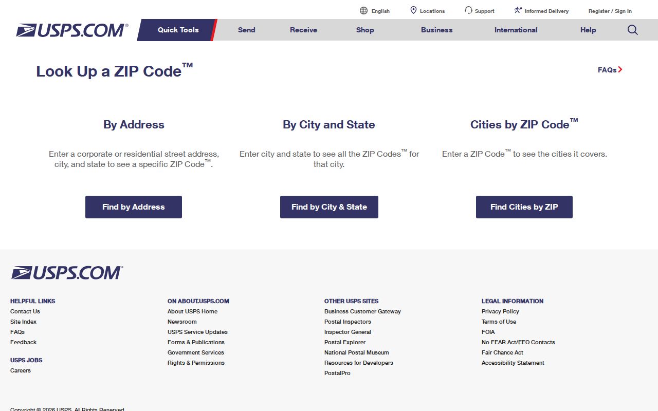
Copy the standardized output into search notes, then use the proper city or county portal for the record itself.
West Allis ZIP Search Fields
Several public systems accept a ZIP, but each searches a different population. MyVote requires ZIP with street and city in its address search, then returns polling place, ballot, and election context. It is not a list of all voters in that ZIP. The West Allis GIS parcel schema includes OwnerZip, which belongs to the owner's mailing address. The public gallery's visible ZIP filter was not captured, though the data service supports field queries.
The Wisconsin DSPS advanced trade search accepts a five-digit or partial ZIP along with credential type, status, and name. WISTAYSAFE also permits a ZIP search under its published legal-use conditions. These sources cannot be merged into a general resident roll. One describes mail, one parcels, one elections, one credentials, and one a limited state registry.
Note: Always label a ZIP field as situs, owner mailing, delivery, credential, or registry geography before comparing results.
Find West Allis Residents by ZIP
Begin a ZIP code lookup with an address, not with an assumption about city limits. The aim is to narrow a West Allis search to the correct delivery area while preserving the record system's own meaning. A parcel result can identify a recorded owner, but it does not name every occupant. An election address result supplies voting context, not a street roster.
- Enter the full address in USPS lookup. Save the standardized street, mailing city, and ZIP returned.
- Open the West Allis property search or GIS parcel layer. Confirm the situs address, tax key, city boundary, and parcel owner fields.
- Use MyVote for the person's own name and birth-date match or an address-based polling search. Use the Badger Voters request route only under its terms and protected-elector rules.
- Search a ZIP-capable specialized record only if it answers the question, such as DSPS for a credential. Verify any named person with an unrelated official record.
Once a ZIP narrows the area to a named road, the West Allis streets directory explains the address and parcel sequence. Keep a separate column for municipality, ZIP, neighborhood, ward, and parcel key. This prevents a postal alias from being mistaken for city jurisdiction.
West Allis ZIP Data Refreshes
Milwaukee County publishes cadastral data in January, March, May, July, September, and November. Property and address data follows in February, April, June, August, October, and December. A cadastral layer describes parcel framework and boundaries; it is not a live list of people. The alternating schedule means two official map layers can carry different update dates without either being a fabricated source.
The city assessor also works through an annual cycle. Record the access date shown with a parcel or assessment result, especially when a sale, mailing-address change, or city boundary question is recent. An owner ZIP may lag a new deed or mailing update, while USPS delivery standardization can change through its own process.
West Allis ZIPs Meet Old Maps
West Allis grew far beyond its early footprint. Honey Creek was established near today's South 81st Street and West National Avenue. The railroad used North Greenfield for the station in 1880, and the area was platted under that name in 1887. West Allis incorporated as a village in 1902 and became a city in 1906. Annexations from Greenfield and Wauwatosa during the 1950s expanded it from about four square miles to roughly 11.5.
Those changes predate today's ZIP system and explain why a historic person or address may be indexed under North Greenfield, a township, Milwaukee, Greenfield, Wauwatosa, or West Allis. The UWM 1948 ward map was later annotated for March 1950 boundaries and polling geography. Use it for historic context, not as a current ZIP code map.
West Allis ZIPs Versus City Limits
The West Allis ZIP code directory cannot substitute for an official municipal map. ZIP 53219 reaches Greenfield, West Milwaukee, Milwaukee, and West Allis. ZIP 53214 also spans West Allis and neighboring Milwaukee-area places. ZIP 53227 serves western and southern West Allis while extending into adjoining areas. A postal code alone cannot identify the city that taxes a parcel, runs its municipal court, issues a permit, or assigns its ward.
Use city GIS for the municipal boundary, USPS for delivery, MyVote for election address matching, and the assessor for parcel facts. School, police, census, ward, neighborhood, and carrier boundaries remain separate. The West Allis ZIP code directory is most useful as a filter when these distinctions stay visible.
- ZIP vs ZIP+4
- A ZIP is the five-digit delivery area. ZIP+4 narrows mail to a smaller segment, building, or group of boxes.
- PO-box ZIP
- A code used mainly or solely for post-office boxes. None was verified as West Allis-specific in the research.
- Unique ZIP
- A code assigned to one high-volume institution. No West Allis unique ZIP was verified.
- Carrier route
- A delivery path within postal geography, not a city, ward, parcel, or census boundary.
When a map and mailing label appear to conflict, retain both with their source dates. Then ask the office whose jurisdiction matters for the task.