
Follow a West Allis Street Directory Trail
The strongest street-by-street search begins with a complete address and keeps every identifier found along the way. West Allis property records distinguish a parcel's physical location from the address used to mail the owner's tax bill. That split matters. A matching mailing and situs address can be a clue, but neither proves that every named person resides at the site. Build the chain one record at a time and save the date of each result.
- Open the city property search or GIS and locate the exact street address.
- Copy the tax key, situs address, owner, mailing label, legal description, and neighborhood.
- Click the parcels on both sides rather than assuming house numbers follow parcel order.
- Use the owner, tax key, and legal description in the Milwaukee County deed system.
- Test a known person in MyVote, then use reverse directories for older occupants.
This method keeps current ownership, recorded transfers, election context, and historic occupancy in separate columns. If the task narrows from a block to one named person, the West Allis resident lookup explains how to verify identity across records.
Walk West Allis Streets in the GIS Parcel Layer
The West Allis GIS Public Gallery is the visual core of a modern street directory. Search or pan to a road, turn on parcel and city-boundary context, then click each polygon in order. Corner parcels, combined lots, and irregular tracts may not match the neat run of house numbers seen from the curb. The public layer supports distance queries, pagination, statistics, and distinct values at its technical endpoint, though a simple consumer radius button was not confirmed.
| GIS field | How it helps a by-address search |
|---|---|
| Property address | Marks the situs, or physical parcel location |
| Tax key | Links the parcel to tax, deed, and older index research |
| Owner and secondary owner | Names carried on the city parcel layer |
| Mailing label, city, state, ZIP | Where owner correspondence is sent |
| Legal description | Subdivision, lot, block, or tract clues |
| Neighborhood, zoning, land use | Place context without identifying occupants |
| Assessment and map link | Valuation context and a saved mapped location |
County land data and city parcel data can refresh on alternating cycles. Record the access date, since a new deed may appear before a parcel field catches up.
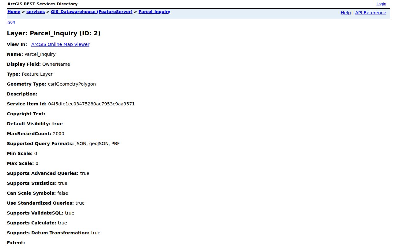
The captured West Allis parcel-layer inventory documents the public attributes behind the map.
West Allis Records That Work by Street
No single West Allis street directory covers every household. Each set has its own key, custodian, and limit. A tax key often joins the modern sources, while a legal description or recorded party name becomes more useful as the search moves back in time.
| Address-keyed source | Public evidence | Street use | Access |
|---|---|---|---|
| Assessor and property card | Owner, mailing, class, value | Compare parcels in one run | City portal or inquiry |
| GIS parcel layer | Polygon, tax key, legal, zoning | Click adjoining land | Public gallery and layer |
| Recorded deed index | Grantor, grantee, tract, transfer | Trace title parcel by parcel | Tapestry, mail, counter |
| Tax and permit files | Dated fiscal or work evidence | Build a parcel timeline | City portal and request |
| MyVote | Matched elector or polling context | Confirm a known person only | Name plus birth date, or address |
| Reverse directory | Historic occupant, phone, business | Read an old block in address order | Library shelf, film, database |
The assessor is maintained by West Allis, deeds by the Milwaukee County Register of Deeds, and election data by Wisconsin election officials. Treat the office named on the record as the final source for corrections or certified copies.
Read a West Allis Parcel Card With Care
The West Allis Assessor links property search, property record cards, assessment rolls, mailing-address changes, and tax information. The city counted 19,765 parcels in its 2025 class comparison, including 17,592 residential parcels. Those are parcels, not residents. A parcel card can establish the city's recorded owner, value class, and site description at a point in time, but it cannot name every person inside a building.
Key terms. A parcel is a mapped unit of land; situs is its physical address; a plat maps lots and blocks; a criss-cross directory lists entries by address.
When the online interface fails to display a needed card, contact the Assessor at 414-302-2489 or use the city record route. For a legal boundary or title claim, rely on a recorded plat, survey, or deed rather than the map polygon. This discipline keeps a by-street list useful without giving a reference map more authority than it has.
Carry a West Allis Street Into the Deed Index
The Milwaukee County Register of Deeds supplies the authoritative title chain. Tapestry and LandRecords allow broad grantor, grantee, tract, and document searches for recordings from 1962 forward. Deeds from April 1, 1948 forward have those broader methods. Older deeds back to 1835 are digitized but require a document number or book and page, so a street address alone may stall.
Start with the current vesting deed. Copy the seller, buyer, document reference, legal description, and transfer date. Search the seller as a prior grantee and repeat. When the chain reaches a subdivision, preserve the lot, block, and plat book reference. Tapestry images are paid and noncertified; county mail or counter service is the path when certification matters. The county also accepts research inquiries by phone at 414-278-4001. Its Digital Reel can bridge tax-key research into assessor indexes from the 1920s through 1989.
The captured LandRecords entry page shows the county-selection gateway used in this stage.

West Allis Permits Put Dates on an Address
Building, electrical, plumbing, HVAC, and occupancy files can mark when work occurred at a West Allis property. Code Enforcement also handles inspections, complaints, referrals, zoning, and property-owner registration. These records may carry an applicant, contractor, or owner lead, but a name on an application does not establish the full household.
The city's permit guidance says review may take up to ten business days. If the current portal does not expose the needed file, call Code Enforcement at 414-302-8400 and use the city open-records route. This fallback is important because the public-facing permit path and the underlying retained record are not always the same thing. Save application and inspection dates, and label the exact role attached to each name.
Why a West Allis Address May Say Milwaukee
Postal labels are a recurring street directory trap. ZIPs 53214, 53219, and 53227 serve West Allis addresses, yet a preferred mailing city may display Milwaukee. ZIP 53214 and 53219 also cross into nearby municipalities. That postal wording does not move a parcel across the West Allis boundary.
Keep municipality, mailing city, ZIP, ward, census block, and parcel in separate fields. Historic work needs still more variants. Honey Creek existed before the North Greenfield station and plat names, the village took the West Allis name in 1902, and the city followed in 1906. Annexations from Greenfield and Wauwatosa in the 1950s widened the city. Test those place labels when an old street search fails, but do not claim a citywide renumbering year because the research did not verify one.
MyVote Is Not a West Allis Street Roster
MyVote's name mode requires first name, last name, and birth date. Its address mode requires street address, unit, city, and ZIP and is designed for polling and ballot context. It does not return a public list of all people on a block. A full Badger Voters request can support authorized geographic filtering, but terms, fees, and protected-elector rules apply.
Use election data only to test a person already known to the search. A no-match result does not prove absence. The service advises trying name variants and address normalization. Protected electors and Safe at Home participants are not ordinary public-address results. City Clerk staff are the correction route for West Allis election records.
Turn a Historic West Allis Street Into Address Order
For past occupants, move from current portals to the regional library shelf. Milwaukee Public Library documents address and reverse searching from 1921 forward, Bresser cross-index volumes from 1969 through 2000, and Milwaukee-area telephone directories in print and on film. Coverage of a given West Allis street varies by volume, so check the title page and geographic scope before using an entry.
Read the abbreviation key first. Search the street, record each printed house number, then turn to the alphabetical section for more detail. Pair the result with a census year, map, obituary, cemetery entry, or deed. The West Allis city directories guide covers the historical shelves and year runs without turning this modern address page into a catalog.
Limits of a West Allis Street Directory
An address search cannot reveal every occupant, child, guest, or mail recipient. It cannot open utility customer lists or restricted driver records. A recorded owner may live elsewhere, a voter result concerns a matched elector, and a permit name may be an applicant rather than a resident. Each clue must retain its source and date.
Use street records with care. Keep this research personal and lawful, respect protected addresses, and never use public clues to stalk, harass, intimidate, or harm anyone.
When a portal is blank, use the custodian's phone, counter, mail, appointment, or Wisconsin Open Records Law route. Absence from a web screen is not proof that no record exists. It may instead reflect the source's date band, privacy rules, indexing method, or a spelling and locality mismatch. That is why a careful West Allis street directory shows its sources instead of presenting guesses as households.