
West Allis Previous Resident Sources
A backward search works best when the source matches the period. The current assessor and GIS record establish the tax key, situs address, owner, mailing fields, and legal description. Recorded deeds then carry the ownership chain into earlier years. Directories and census schedules add the people who actually occupied the site, while permits and maps help date changes to the building.
| Source | Years It Covers | Where Held | What It Shows |
|---|---|---|---|
| Assessor and GIS | Current roll and parcel layer | West Allis portals | Owner, situs, mailing fields, tax key, legal description |
| Recorded deeds | 1835 to present, with search-method cutoffs | Milwaukee County Register of Deeds | Grantor, grantee, recording date, document reference, parcel description |
| Digital Reel | 1920s through 1989 | County Register of Deeds route | Milwaukee City assessor index by tax key |
| West Allis directories | Located volumes from 1904 through 1960 | Library and genealogy databases | Names, addresses, work, spouse, roomer, phone, or reverse entries |
| Federal census | Public schedules through 1950 | NARA, libraries, genealogy databases | Household on the census date |
| Permits and maps | Varies by collection | City requests, UWM, MPL, WHS | Construction dates, footprints, use, and block context |
For a recent question, begin with the West Allis Assessor and public parcel data. For an early twentieth-century question, a directory may identify the household faster, but the deed still controls ownership. Older work often moves back and forth between sources.
Start West Allis Records Today
The West Allis public parcel layer exposes the fields needed to anchor past residents to the right land: tax key, full property address, owner, secondary owner, owner mailing lines, legal description, neighborhood, zoning, land use, assessment, living units, and last sale date. Copy the tax key and legal description exactly. Those identifiers are more durable than a house number.
Situs means the place where the property is located. The owner's mailing address is where a tax bill or notice goes. A different mailing city or ZIP may be useful, but it does not prove that an owner lived elsewhere. Trusts, estates, and businesses can also appear as owners. Treat the parcel record as a starting snapshot, not a list of all past residents.
The parcel-layer source is shown below as captured in the project manifest.
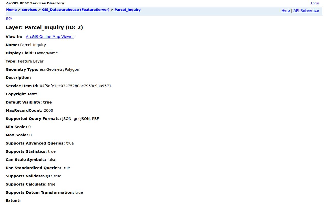
The captured field inventory shows why the tax key, property address, owner mailing fields, and legal description should be recorded as separate facts.
Note: County property and address datasets refresh on alternating every-other-month cycles, so date each parcel result.
Trace West Allis Resident Deeds
The Milwaukee County Register of Deeds is the authority for the ownership chain. Modern searches support grantor, grantee, tract, and document number. Read the transfer document rather than relying on the tax roll alone, because assessment data can lag a recording.
- Copy the current owner, tax key, and legal description from the West Allis record.
- Find the deed that transferred the parcel to the current grantee, meaning the recipient.
- Record the grantor, document number, date, consideration, and prior deed reference.
- Search that grantor as an earlier grantee, checking the same lot, block, and legal description.
- Repeat until the search method changes, then use document or book-and-page references.
- Grantor and grantee
- The grantor transfers an interest; the grantee receives it.
- Chain of title
- The linked sequence of recorded transfers for one parcel.
- Legal description
- The lot, block, subdivision, or metes-and-bounds text that identifies land independent of its mailing address.
The cutoffs matter. All recordings from 1962 forward have broad search methods. Deeds from April 1, 1948 forward can also be found that way. Earlier deeds, from 1835 through March 31, 1948, require a document number or book and page. Plats through June 1991 likewise use document or plat-book references; later plats have broader options.
West Allis Resident Deed Access
LandRecords and Tapestry provide the online index route. The captured county selection and search screen is useful for discovery, but paid online images are noncertified.
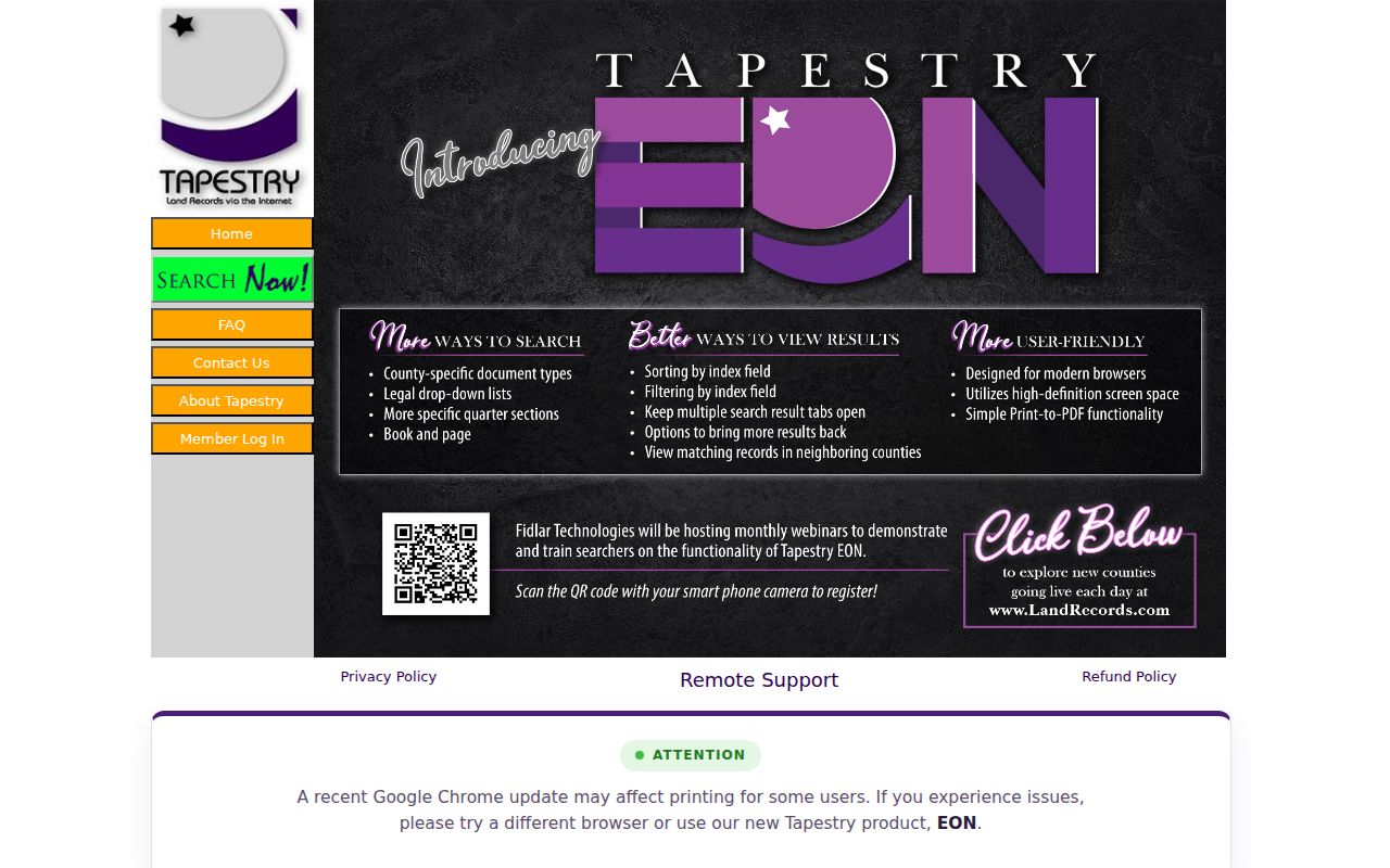
The screen is only one access channel. A mail or counter copy request can ask for certification and should include document type or number, property address, requester contact, certification choice, and payment. Historical research appointments require at least 24 hours' notice. Staff can guide use of the archive, but they do not conduct a full title search. Laredo is the subscription route for frequent users.
| Route | Best use | Limit |
|---|---|---|
| Tapestry | Occasional index and image research | Online image is not certified |
| Mail or counter | Official copy request | Needs a precise document reference |
| Archive appointment | Older books and index work | Researcher follows the chain |
Bridge West Allis Resident Gaps
Milwaukee County's Digital Reel is a local bridge when the current tax key must connect to older index references. It covers Milwaukee City Tax Assessor grantor and grantee material from the 1920s through 1989 and is indexed by tax key. It is not a general statewide deed search, nor a promise that every West Allis parcel appears. Still, it can supply the kind of reference needed when a pre-1948 deed cannot be searched by a current owner's name.
Search-method quirk. Before April 1, 1948, recover a document number or book and page before expecting an old deed image.
Online discovery and an official copy are different products. Use the index to identify a likely instrument. Then order the recorded item through the county if the exact text or certification matters. This step keeps previous residents research tied to the recorded parcel.
Match West Allis Past Households
A deed names parties to a transfer, not everyone who lived in the home. The directory and census layer can place previous residents at the address. Located West Allis directory years include 1904, 1910, 1912, 1913, 1916, 1918, 1921, 1923, 1925, 1927, 1929, 1932, 1936, 1938, 1940, 1942, 1945, 1950, 1953, 1957, and 1960. That is a verified list, not proof of a continuous run.
The Milwaukee Public Library local-history collection has name access across its Milwaukee directory years, address or reverse access from 1921 forward, Bresser cross-index volumes for 1969 through 2000, telephone books, and digitized 1861 through 1960 material through Ancestry at the library. The specific collections are treated in depth on the West Allis city directory page.
- Find the printed address in the closest available directory year.
- Copy every named occupant and the directory's abbreviations.
- Check the nearest public census, now available through 1950 under the 72-year rule.
- Compare household members, ages, relationships, and occupancy status without forcing a match.
- Use the next directory year to test a move, death, or name change.
A directory may have been compiled before its cover year. A census describes one census date. Note those timing differences in the working timeline.
Test Old West Allis Resident Names
Place names can break a clean address search. The community grew from Honey Creek and North Greenfield, became the Village of West Allis on May 31, 1902, and became a city on April 2, 1906. Annexations from Greenfield and Wauwatosa in the 1950s expanded it from about four square miles to roughly 11.5. An address may therefore appear under a township, North Greenfield, West Allis, Milwaukee, or a neighboring municipality, depending on the date and source.
Milwaukee has an official 1930 address-change converter, but no source verified a separate citywide West Allis renumbering year. Do not impose Milwaukee's change on West Allis. Compare the printed directory address with the parcel legal description, subdivision plat, and period map instead.
Note: Test West Allis, North Greenfield, Honey Creek, Milwaukee, and township labels when an expected directory entry disappears.
Date West Allis Resident Addresses
The MPL House History guide offers a useful sequence: locate an address in a directory, expand the person's entry for work details, then add property, photo, tax, and premises sources. Its Milwaukee premises files do not automatically cover West Allis, so verify jurisdiction before asking for one.
For West Allis, use permit issue and final-inspection dates for alterations or demolition, assessment changes for a new improvement, and Sanborn or fire-atlas footprints to test whether a structure existed. Regional Sanborn evidence includes a documented 1910 sheet and MPL atlases from the mid-1870s through the 1960s, but the exact West Allis run was not established. City Code Enforcement or an open-records request can be used when stable online permit images are unavailable.
These sources date the building, not the household. A deed can transfer title without a move, and a permit applicant may not be an occupant.
Close West Allis Resident Trails
Obituaries, cemetery records, and probate can explain why a name leaves the directory or a parcel passes to heirs. West Allis Public Library offers NewsBank and Heritage Hub for local news and death notices. Milwaukee County probate files can identify heirs, inventories, estates, and land or building descriptions. Access varies by date: pre-1985 files are at the counter, 1985 through June 1, 2003 is mixed, and later case information is in WCCA.
The Honey Creek Cemetery listing covers 1849 through 1974 and can add burial dates, lots, and family links. Its unusually clear provenance includes original association records and minutes, headstone photographs, genealogy work, and a later supervised transcription. It is a strong research lead, not a certified vital record.
When a death predates statewide registration, the Wisconsin Historical Society pre-1907 index and microfilm route may provide the next step. Keep negative searches as evidence too. They show where and when a name was tested.
Use Previous Residents Records Lawfully
Past-household research supports genealogy, estate questions, architectural history, and personal curiosity. It does not justify tracking a living person. Safe at Home can replace a participant's actual address with an assigned address, and Wisconsin law also protects confidential electors. Public utility customer lists and DMV personal addresses are not address-history sources.
Separate fact from inference. A recorded owner may never have occupied the parcel. A directory occupant may have been a renter, roomer, or relative. An obituary address may describe the end of a life rather than the full period of residence. Use two independent records before declaring who lived here before.
Lawful use. Research West Allis previous residents for house history, family history, or estate work. Never use records to watch, harass, intimidate, or harm a living person.